Wildfire Severity Remote Sensing Analysis
Wildfire Severity Comparison Using Google Earth Engine & JavaScript
Overview: Graduate Remote Sensing Coursework. I conducted a geospatial analysis comparing two Southern California wildfires in order to identify differences in burn severity over time and inform potential preventative and restorative wildfire measures.
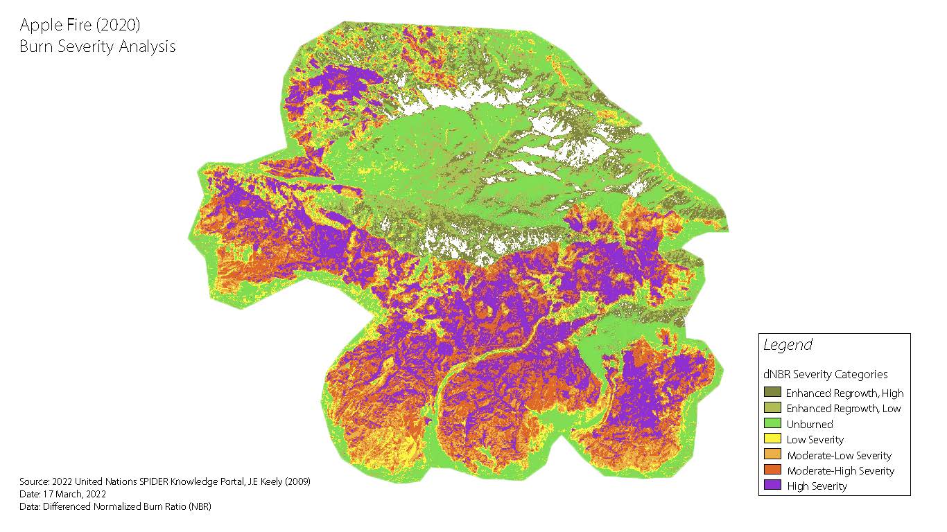
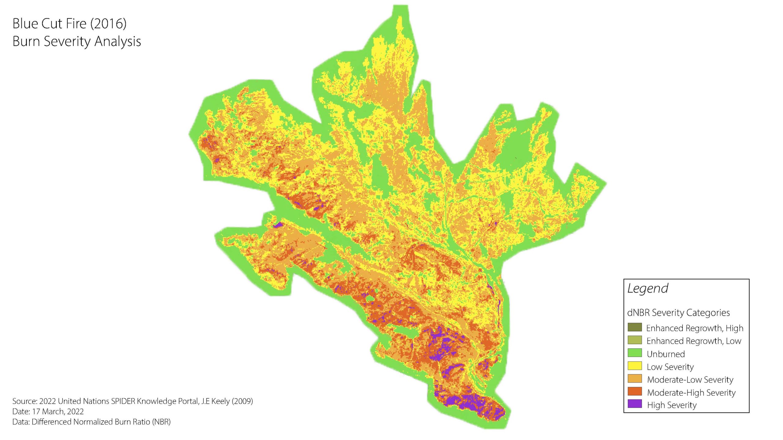
What I did: Using the Google Earth Engine API and JavaScript, I compared the 2020 Apple Fire and the 2016 Blue Cut Fire. My code included Cloud and Snow masks, Mosaic Clipping, and Pre-Post NBR Calculations. I used established indexes such as the Normalized Burn Ratio (NBR) to highlight differences in burn severity.
Results: My analysis showed a significant increase in burn severity between the 2016 and 2020 wildfires, despite heavy similarities in makeup. This report highlights the importance of stronger restoration efforts in high-risk wildfire areas. Specifically, reseeding and routine fire maintenance were two actions to mitigate loss. This geospatial analysis and report hold valuable insights that can inform future wildfire prevention and response strategies.


